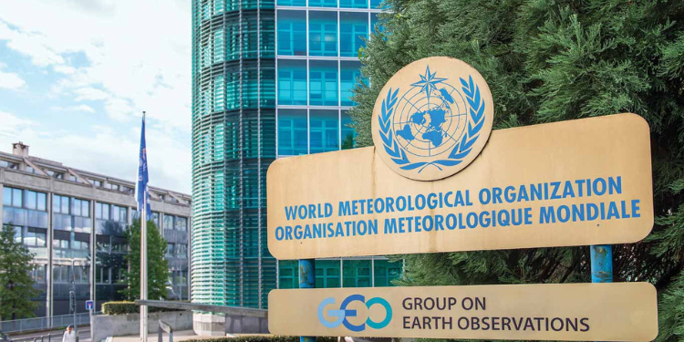



The World Meteorological Organization (WMO) has forecast an unusually strong El Niño event, with sea surface temperatures in the tropical Pacific expected to rise to about 3.8°C above average between November 2026 and January 2027.
The United Nations weather agency said the warming is expected to peak around December 2026, raising the prospect of significant shifts in rainfall and temperature patterns across different parts of the world.
In its Global Seasonal Climate Update, prepared on October 20, 2026, WMO said forecasts from multiple climate models indicate further intensification of El Niño conditions during the November 2026 to January 2027 period.
“For the November 2026–January 2027 (NDJ 2026–27) season, multi-model ensemble forecasts indicate a further intensification toward stronger El Niño conditions. The seasonal average Niño 3.4 SST ensemble mean anomaly is forecast to reach approximately +3.8°C during NDJ 2026–27, with the warming trend peaking around December 2026,” the report stated.
“The spread among individual forecast systems generally remains narrow, reflecting high forecast confidence.”
WMO Secretary-General Celeste Saulo has warned that the event could exceed the scale of monitoring charts used over the past four decades, highlighting the need for countries to prepare for its potential effects.
El Niño is a natural climate phenomenon characterised by warmer-than-average sea surface temperatures in the central and eastern equatorial Pacific Ocean. It influences atmospheric circulation and can shift rainfall and temperature patterns far beyond the Pacific.
Although the warming is expected to peak towards the end of 2026, its influence on weather patterns could continue into 2027.
What El Niño Could Mean for Kenya
The WMO outlook points to a higher chance of above-normal rainfall across the Greater Horn of Africa between November 2026 and January 2027.
The forecast raises the possibility of wetter conditions in parts of the region during a period when rainfall patterns are particularly important for agriculture, water supplies and communities exposed to flooding.
In Kenya, above-normal rainfall could affect farming, transport, water management and settlements in flood-prone areas.
WMO said the consistency among models forecasting rainfall changes across Africa was low to moderate, indicating uncertainty in the precise distribution of rainfall.
The agency’s seasonal update is intended to guide regional climate centres and national meteorological services. It is not an official forecast for an individual country.
The outlook also points to an increased likelihood of below-normal rainfall in parts of southern Africa south of 10 degrees south latitude, showing that the effects of El Niño will vary across the continent.
Also Read: Kenya Met Explains Why El Niño Rains Have Delayed as Kenyans Grow Impatient
WMO Forecasts Warmer Conditions Across Africa
Beyond rainfall, WMO expects above-normal temperatures to be more likely across large parts of the world during November 2026 to January 2027.
The forecast identifies Africa among the regions expected to experience an increased probability of warmer-than-normal conditions. A strong signal for above-normal temperatures is also projected across parts of South America between the equator and 30 degrees south.
Other areas with an increased likelihood of above-normal temperatures include southern Europe, the Arabian Peninsula, the Indian Subcontinent, Eastern Asia, Central America and the Caribbean.
Across the tropical regions, the outlook points to a particularly strong likelihood of above-normal temperatures over equatorial Africa, equatorial South America and the Maritime Continent.
Over the Pacific Ocean, the forecast shows an above-normal temperature probability exceeding 80 per cent across a broad area east of the International Date Line, extending towards the coast of South America.
WMO said the forecast pattern reflects the influence of the strong El Niño event developing in the tropical Pacific.
Rainfall Patterns Expected to Shift Worldwide
The forecast also identifies major changes in the probability of rainfall across several regions.
Above-normal rainfall is more likely across the central and eastern equatorial Pacific, while an extensive area of below-normal rainfall is forecast over parts of the western Pacific and the equatorial Atlantic.
The outlook also shows an increased probability of above-normal rainfall extending from the Arabian Peninsula through Central Asia into Eastern Asia, particularly in coastal and nearby areas.
In the Americas, below-normal rainfall is more likely across northern South America, extending south to about 15 degrees south. Above-normal rainfall is more likely across southeastern South America, while drier-than-normal conditions are more likely toward the southern tip of the continent.
Southern Central America and the Caribbean are also forecast to have a higher likelihood of below-normal rainfall.
In Europe, the outlook indicates a weak increase in the probability of above-normal rainfall, with low-to-moderate consistency among forecast models. Australia is expected to experience a weak signal for above-normal rainfall in parts of its interior and southern regions.
Also Read: Kenyans Warned of Dangerous Sea Conditions, Flash Floods and Rain Expected in 44 Counties
Indian Ocean Dipole Expected to Weaken
Alongside the strengthening El Niño, the WMO expects the positive Indian Ocean Dipole (IOD) to weaken toward its long-term average during November 2026 to January 2027.
The report forecasts a seasonal mean IOD anomaly of approximately +0.3°C.
The Indian Ocean Dipole is a climate pattern associated with differences in sea surface temperatures between the western and eastern parts of the tropical Indian Ocean. Changes in the IOD can influence rainfall patterns in East Africa and other regions surrounding the Indian Ocean.
During July to September 2026, the positive IOD strengthened, with the observed index rising from +0.3°C in July to +0.9°C in September. The seasonal average for that period was +0.6°C.
The latest outlook suggests the positive phase will ease over the next three months.
Meanwhile, sea surface temperatures in the North and South Tropical Atlantic are expected to remain above normal.
WMO said warm sea surface temperature anomalies had also persisted across the equatorial and subtropical Atlantic, as well as much of the North Pacific, during the July–September period.
El Niño Strengthened Between July and September
The latest forecast follows a period of sustained warming in the equatorial Pacific.
WMO reported that the Niño 3.4 index rose from +2.0°C in July 2026 to +2.5°C in August and +2.8°C in September.
The July-September average stood at +2.4°C above the 1991–2020 average, indicating that El Niño conditions were already well established across the equatorial Pacific.
For November 2026, the multi-model forecast puts the Niño 3.4 anomaly at approximately +3.7°C. It is projected to reach +3.8°C in December before easing slightly to +3.7°C in January 2027.
The average for the full November–January period is forecast at +3.8°C, with a standard deviation of 0.5°C.
The report uses different historical reference periods for different parts of its analysis. The report compares observed oceanic indices with the 1991–2020 average, while the seasonal temperature and rainfall probability maps use a 1993–2009 baseline.
WMO Urges Countries to Prepare for Weather Risks
The forecast highlights the importance of early-warning systems and advance planning as countries prepare for potentially disruptive weather conditions.
Governments, humanitarian organisations and communities can use seasonal climate outlooks to inform decisions on disaster preparedness, water management, agriculture and other activities sensitive to changes in weather patterns.
For areas at risk of flooding, preparations may include monitoring river levels, maintaining drainage systems and ensuring that emergency services can respond to warnings. In regions where drier conditions are expected, water conservation and agricultural planning may become more important.
WMO nevertheless cautions that seasonal outlooks are probabilistic. A region identified as having an increased likelihood of above-normal rainfall can still experience normal or below-normal rainfall.
Follow our WhatsApp Channel and X Account for real-time news updates.