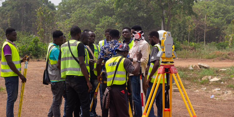
Land surveying in Kenya is regulated by the Land Surveyors’ Board (LSB), the statutory body responsible for overseeing training, licensing, and maintaining professional standards for all practitioners in the field.
Full Process of Becoming a Licensed Land Surveyor
Step 1: Academic Qualification
The journey to becoming a licensed land surveyor begins with formal education in land surveying or a closely related discipline.
Aspiring surveyors can choose from three main academic pathways:
- Certificate in Land Surveying
Entry Requirement: KCSE mean grade D, with at least a D in English, Mathematics, and Physics.
Duration: 2 years. - Diploma in Land Surveying
Entry Requirement: KCSE mean grade C-, with at least a C- in English, Mathematics, and Physics.
Duration: 3 years. - Bachelor’s Degree in Land Surveying or Geospatial Engineering
Entry Requirement: KCSE mean grade C+, with at least a C+ in Mathematics, Physics, and English.
Duration: 4 years.
These programs are offered by accredited institutions, such as the Kenya Institute of Surveying and Mapping (KISM), the Technical University of Kenya (TUK), and the Jomo Kenyatta University of Agriculture and Technology (JKUAT).
The academic foundation equips students with essential knowledge in cartography, geodesy, remote sensing, and GIS technologies.
Step 2: Practical Training
Upon completing formal education, candidates must undergo supervised field training.
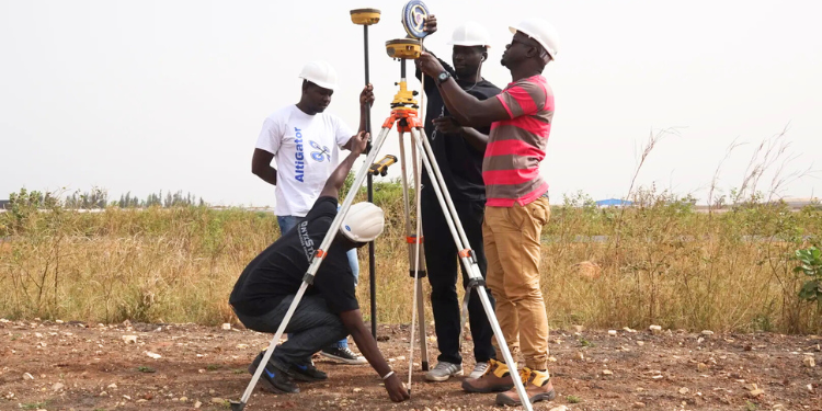
This phase involves working under the guidance of a licensed land surveyor to gain hands-on experience in various surveying tasks.
These include boundary demarcation, topographic mapping, and cadastral surveys.
The mentorship surveying principles, legal procedures, equipment handling, and data analysis.
This step is mandatory and serves as a requirement for the licensing examination.
Step 3: Licensing Examination
After fulfilling academic and practical training requirements, candidates must apply to the Land Surveyors’ Board to sit for the professional licensing examination.
The application process requires submission of academic transcripts, proof of supervised fieldwork, and other relevant documentation.
The examination evaluates the candidate’s proficiency in technical surveying methods, understanding of land laws, and adherence to ethical standards.
A successful performance in this exam qualifies the candidate for registration and licensing.
Step 4: Registration and Licensing
Candidates who pass the licensing examination are formally registered by the Land Surveyors’ Board.
Upon registration, the Board issues a land surveying license, granting the individual legal authority to practice as a professional surveyor in Kenya.
The surveyor’s name is added to the national register of licensed land surveyors, confirming their eligibility to undertake official surveying assignments, including boundary verification, land subdivision, and mapping projects.
Step 5: Professional Membership
While not mandatory for licensing, joining professional bodies is highly encouraged.
These organizations promote industry standards, offer training opportunities, and provide platforms for networking and advocacy.
Key bodies include:
- Institution of Surveyors of Kenya (ISK): Offers professional development programs, policy engagement, and member support.
- Association of Licensed Land Surveyors of Kenya (ALLSK): Focuses on the welfare and interests of licensed surveyors.
- Kenya Institute of Surveying and Mapping (KISM): Provides specialized technical courses and supports continuous learning.
Also Read: How to Apply for a Mineral Export Permit in Kenya
Membership in these bodies enhances professional credibility and ensures surveyors remain informed about industry trends and regulatory changes.
Step 6: License Renewal and Continuing Development
Licensed land surveyors are required to renew their licenses annually through the Land Surveyors’ Board.
Renewal is contingent upon proof of active professional practice and participation in Continuing Professional Development (CPD).
Also Read: How to Apply for a Mining License in Kenya
CPD programs, such as training in Global Navigation Satellite Systems (GNSS), AutoCAD, and cadastral mapping, are available through institutions like KISM.
These courses help surveyors stay current with technological advancements, legal updates, and best practices in the field.
Follow our WhatsApp Channel and X Account for real-time news updates.







































![Senator Allan Chesang And Chanelle Kittony Wed In A Colourful Ceremony [Photos] Trans Nzoia Senator Allan Chesang With Channelle Kittony/Oscar Sudi]( https://thekenyatimescdn-ese7d3e7ghdnbfa9.z01.azurefd.net/prodimages/uploads/2025/11/Trans-Nzoia-Senator-Allan-Chesang-with-Channelle-KittonyOscar-Sudi-360x180.png)
