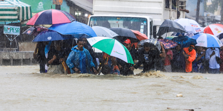
The Kenya Meteorological Department (KMD) has issued an update on Cyclone Chenge, a weakening tropical system currently located north of Madagascar. In its Daily Cyclone Activity Bulletin released late on Saturday, October 25, 2025, Kenya Met warned of heavy rains and strong winds expected along parts of the Tanzanian and southern Kenyan coasts early next week as the Cyclone moves westward across the southwest Indian Ocean.
The Weatherman said the low-pressure system, now classified as a residual depression, was located near 8.2°S / 50.2°E, about 500 kilometres north of Madagascar.
Kenya Met Issues Cyclone Chenge Update, Warns of Heavy Rains and Strong Winds Along the Coast
The system is moving west-northwest at 11 km/h with maximum sustained winds of 55 km/h, gusting up to 75 km/h, and a central pressure of 1000 hPa.
“KMD continues to monitor tropical weather systems over the southwest Indian Ocean,” read the update.
“A low-pressure system, Chenge (Residual Depression), is currently located near 8.2°S / 50.2°E, about 500 km north of Madagascar, moving west at 11 km/h.”
According to the forecast, Chenge is expected to continue drifting west-northwest across the northern Mozambique Channel, gradually losing strength.
Also Read: Kenya Met Issues Floods and Landslides Alert
According to the forecast, the system is likely to dissipate near the coasts of Tanzania and southern Kenya by Tuesday.
KMD noted that although no cyclone alert has been issued for Kenya, the weakening system could still cause heavy rainfall and strong winds exceeding 25 knots along southern coastal areas such as Kwale, Mombasa, and Lamu counties on Monday and Tuesday.
Fishermen and marine operators have been advised to exercise caution due to possible rough seas and strong gusts.
Elsewhere, the weatherman indicated that Mayotte will not be under cyclone alert but could experience swells of around two metres between Sunday and Monday.
The Astove and Aldabra archipelagos in the Seychelles are expected to see heavy rain and dangerous sea conditions through the weekend, while northern Madagascar will remain mostly clear, with only localized rough seas possible.
KMD further confirmed that no other tropical systems are expected to develop in the southwest Indian Ocean over the next five days, providing some relief to coastal communities in the region that have recently experienced heightened weather activity.
“The department will continue to closely monitor the situation and issue updates as necessary,” KMD said in its statement.
It also urged members of the public, to stay alert and follow official weather updates through verified channels.
Also Read: Kenya Met Lists Areas to Receive Heavy Rainfall as October Comes to an End
Floods and Landslide Alert
This comes after Kenya Met issued a heavy rainfall advisory on Wednesday, October 22, 2025, warning of floods and landslides in select parts of the country.
KMD warned that rainfall is expected to intensify to more than 30mm within 24 hours and will spread to the Highlands east of the Rift Valley, including Nairobi and its surrounding areas, on Thursday, October 23, 2025.
“Rainfall currently affecting parts of the Lake Victoria Basin, the Rift Valley, and the Highlands west of the Rift Valley is expected to intensify to more than 30mm in 24 hours and spread to the Highlands east of the Rift Valley, including Nairobi and parts of the southeastern lowlands, on Thursday, October 23, 2025,” read part of the statement.
According to Kenya Met, the heavy rainfall is expected to continue and extend to parts of the northeast starting Thursday, October 30.
This is likely to mark the beginning of the Short Rains Season (OND) 2025 in several parts of the country, except for some areas in the southeastern lowlands and the coastal region.
Follow our WhatsApp Channel and X Account for real-time news updates.


