

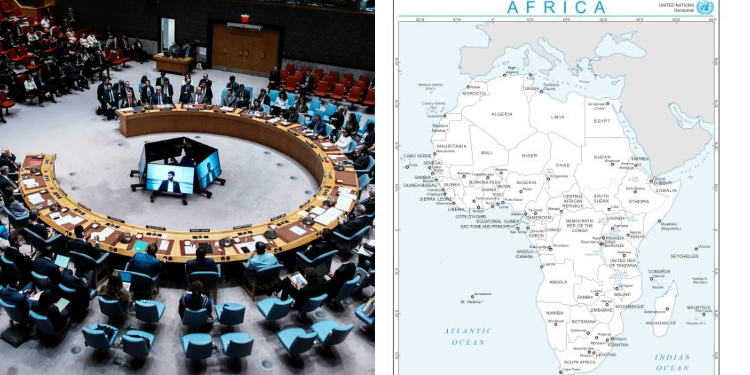
The United Nations (UN) General Assembly has endorsed an African-led initiative to adopt world map projections that more accurately represent the relative sizes of continents and regions.
Speaking ahead of the vote on September 5, Togo’s Foreign Minister Robert Dussey argued that maps play a significant role in shaping how people perceive the world, particularly through education and public understanding.
“Maps shape our understanding of the world. They guide education, nourish the imagination, and influence collective perceptions,” Dussey said.
“It’s time for us in Africa to take responsibility to change what we can change ourselves.”
The resolution, known as “Correct the Map,” was introduced by Togo on behalf of the 54-member African Group at the United Nations and received backing from the African Union.
A total of 164 countries voted in favour, one opposed the measure and six abstained, with the United States (US) casting the only vote against it.
Why the US Opposed While the UN Supported
Speaking on behalf of the US at the United Nations, representative Yaryna Ferencevych criticized the resolution, arguing that the General Assembly should focus on pressing issues such as international peace, prosperity, and relations between countries rather than historical map projections.
She also questioned the resolution’s references to reparations and “cognitive justice”, describing the debate as a distraction from the body’s core responsibilities.
Kenyan geographer Kioko Muendo said maps can influence how countries and regions are viewed economically and politically, arguing that the Mercator projection has contributed to an understated perception of Africa’s size, resources, population and investment potential.
“Maps are more than just guides for travellers – they shape how regions are perceived politically and economically,” he told the BBC.
Also Read: The Role of the United Nations in Addressing Severe Diseases in Africa
What It Means For Africa
The resolution does not require countries, international organizations or schools to abandon the Mercator projection, a mapping system that has been widely used for centuries.
Instead, it promotes the use of equal-area projections, such as the Equal Earth map, which are designed to show the relative size of land masses more accurately.
Under the Mercator projection, regions farther from the Equator appear larger than they are, making Africa look smaller by comparison. Equal-area maps address this distortion by preserving the proportional size of continents and countries, although their shapes can appear somewhat different.
Also Read: Why United Nations Won‘t Intervene in Kenya’s Situation Immediately
The Correct the Map campaign urges governments, international organizations, and educational institutions to adopt the Equal Earth projection in maps and teaching materials.
Created in 2018 by cartographers Tom Patterson, Bernhard Jenny and Bojan Šavrič, Equal Earth was designed to provide a more accurate comparison of the world’s land areas while accepting some distortion in the shape of countries and continents.
The resolution adopted by the General Assembly is non-binding, meaning its approval does not force any country or institution to change the maps it currently uses.
Follow our WhatsApp Channel and X Account for real-time news updates.