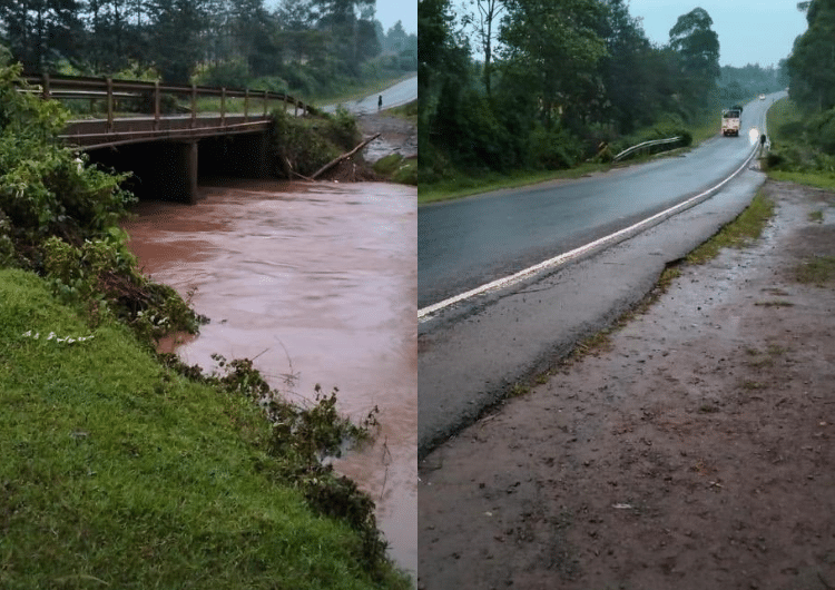



The Kenya National Highways Authority (KeNHA) has announced that the Kipsonoi River Bridge at Mugeni, along the Kaplong–Kisii (B6) Road between Sotik and Chebilat, is flooded and unsafe for traffic.
In a notice dated March 21, 2026, KeNHA stated that the flooding was caused by heavy upstream rainfall, which caused a significant rise in water levels.
“The Kenya National Highways Authority (KeNHA) wishes to notify the public that the Kipsonoi River Bridge at Mugeni, located between Sotik and Chebilat along the Kaplong Kisii (B6) Road, has experienced flooding, rendering the section unsafe for motorable traffic,” read part of the notice.
The authority urged motorists to follow instructions from police officers and traffic marshals stationed at the site to ensure safety.
“Motorists are strongly advised to exercise caution and strictly adhere to instructions issued by police officers and traffic marshals on site to ensure their safety.”
KeNHA Lists Alternative Routes as Kipsonoi River Bridge Floods
According to KeNHA, motorists affected by the closure can use alternative paved routes to reach their destinations safely.
Also Read: KeNHA Lists Alternative Diversion Routes Ahead of Safari Rally Weekend
For travelers heading to Chebilat and Keroka, the suggested alternative route is Kaplong → Sotik → Roret → Ikonge → Chebilat → Keroka.
Similarly, motorists travelling to Kisii are advised to take the Kaplong → Sotik → Roret → Ikonge → Kisii route.
The authority added that it will closely monitor the situation and take further action should water levels continue to rise.
KeNHA Issues Advisory as Floods, Silt Slow Traffic near Suswa
Earlier, the Kenya National Highways Authority (KeNHA) warned motorists of severe travel disruptions along the Mai Mahiu–Suswa–Narok (B7) Road due to heavy rains that have caused flooding and silt deposits.
The most affected stretch was at Kedong Ranch near Suswa, where water levels made driving dangerous and slowed traffic.
KeNHA urged drivers not to ignore safety instructions, as navigating flooded sections or silted areas could result in vehicles being stranded or swept away.
“As the area continues to receive heavy rainfall, motorists are further urged to exercise extreme caution when driving along various sections of the road, particularly between Naivasha ICD (Km 14) and Suswa Ranch (Km 39),”
Also Read: Alternative Routes for Motorists as KeNHA Announces 7-Day Closure of Thika Superhighway
Additionally, the authority advised travellers who had not yet started their journeys to postpone their trips until the floodwaters recede.
However, those who had to travel could use alternative routes, including Ngong–Suswa, Nairobi–Naivasha–Nakuru–Mau Narok–Narok, and Nairobi–Naivasha–Longonot–Suswa.
Reassuring road users, the Authority said it is working to clear the affected areas and secure safe travel.