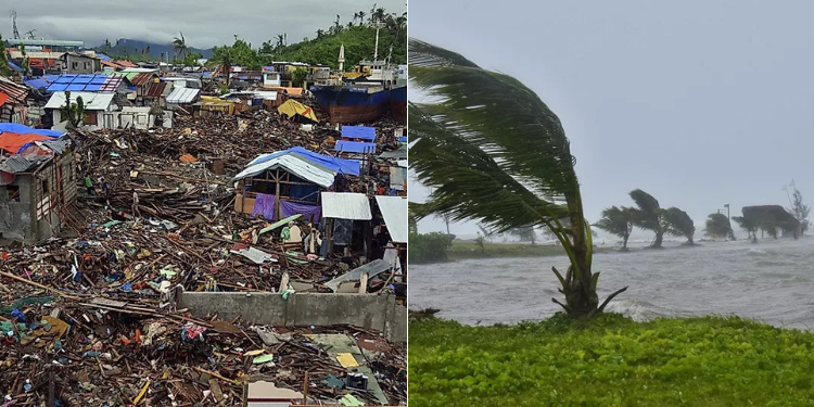
The Kenya Meteorological Department has issued an update on the impending arrival of Cyclone Hidaya along the coastal regions.
In a statement shared on social media on Saturday, May 4, the weatherman urged residents along the coast to brace themselves for the cyclone’s impact.
According to the Weather forecast department, the cyclone is expected to make landfall with fierce winds exceeding 40 knots and unleash large ocean waves towering over two meters high in the Indian Ocean from May 2nd to 6th, 2024.
“The coastal area is expected to experience the effects of Cyclone Hidaya, with powerful winds surpassing 40 knots and significant ocean waves over 2 meters high,” said the Kenya Met.
This alert comes in the wake of recent devastating floods and heavy rains in East Africa, which have resulted in a tragic loss of lives and the displacement of thousands of individuals.

Additional Warnings
In a subsequent statement, Kenya Met said current observations indicate that the Tropical Cyclone Hidaya has made landfall on the coast of Tanzania. However, the statement added that there is another depression developing behind it, which the Department is monitoring closely.
Moreover, the Kenya Meteorological Department has extended its warnings beyond the coastal areas, indicating that heavy rainfall exceeding 40mm in 24 hours is expected in various parts of the country.
“Rainfall of more than 40mm in 24hrs pounding several parts of the Lake Victoria Basin, the Rift Valley, Highlands West and East of the Rift Valley including Nairobi area and Southeastern lowlands is likely to continue from Thursday 2-5 May 2024,” stated the weatherman.
Also Read: Cyclone Hidaya: Ruto, Samia Suluhu Issue Warning as Storm Nears Tanzania & Mombasa
“Areas of Concern: (Heavy rainfall): Nandi, Kericho, Bomet, Kakamega, Vihiga, Bungoma, Narok, Baringo, Nakuru, Trans-Nzoia, Uasin-Gishu, Elgeyo-Marakwet, Weft-Pokot, Kisumu, Homa Bay, Siaya, Migori, Busia, Kisii, Nyamira, Nyandarua, Laikipia, Nyeri, Kirinyaga, Murang’a, Kiambu, Meru, Embu, Tharaka-Nithi, Nairobi, Machakos, Kitui, Makueni, Kajiado, Turkana, Samburu, Marsabit, Mandera, Wajir, Larissa and Isiolo Counties.”
The forecast also includes details of strong southerly winds of more than 30 knots in specific regions, with concerns raised for areas like Mombasa, Tana-River, Kilifi, Lams, Kwale, Taita-Taveta, and Garissa counties.
Residents were urged to exercise caution and avoid areas prone to flooding, as well as open fields and trees during the storm to minimize potential risks of accidents or lightning strikes.
Cyclone Hidaya
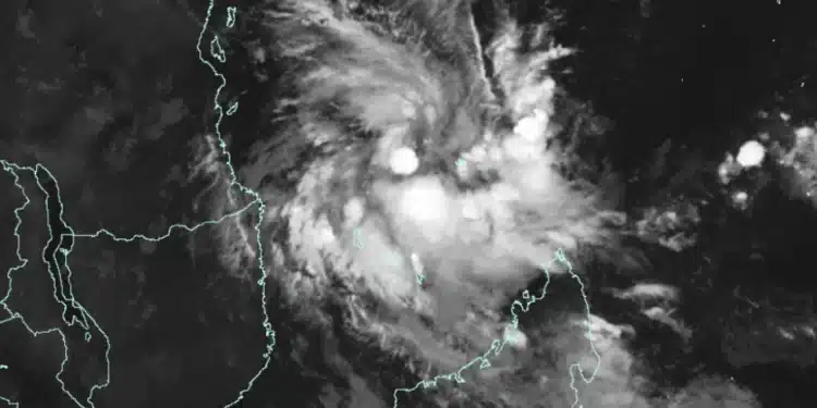
Cyclone Hidaya, originating from the South Indian Ocean, east of Tanzania and north-northeast of the Comoros, is expected to bring heavy rainfall, strong winds, and large waves from May 2 to May 6, 2024.
The government announced on May 2 that the country, particularly in the coastal region, could be hit by the tropical Cyclone Hidaya.
A report by State House noted that the cyclone may bring with it heavy rainfall, large waves and strong winds that could affect marine activities in the Indian Ocean.
The Tanzania Meteorological Authority (TMA, on its part, predicted that the storm is expected to approach the country’s Coast between Thursday and Monday.
In an updated statement TMA, noted that Cyclone Hidaya is currently located near the coastal areas of the country.
Also Read: Cyclone Hidaya: All You Need to Know About Storm Set to Hit Kenya
“As of 9 pm today, Cyclone “HIDAYA” was in the sea area approximately 125 kilometers from the coast of Kilwa (Lindi Region), 93 kilometers from the coast of Mafia and 128 kilometers from the coast of Dar es Salaam with an air pressure of 985 hPa and a wind speed of up to 120 kilometers per hour,” said TMA.
The TMA expects Cyclone Hidaya to continue moving closer to the coastal zone, causing more episodes of heavy rain and strong winds, particularly in the Lindi, Pwani, and Dar es Salaam regions, as well as the island of Unguja.
The authority has advised citizens and those involved in maritime activities to exercise caution and closely monitor the weather updates and guidance from experts.
Do you want to be part of an updated community without the interruptions of unwanted messages? Click the link below and join our WhatsApp Channel!
https://whatsapp.com/channel/0029VaB3k54HltYFiQ1f2i2C


