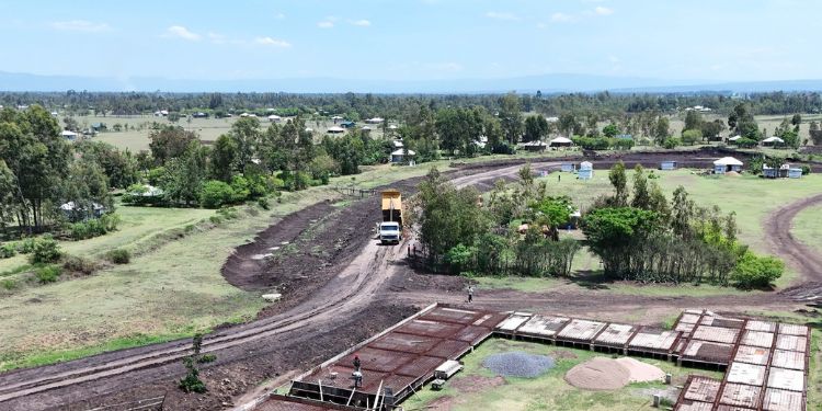
The government has made efforts to provide a long-term solution to flooding in West Kano, Kisumu County, with the ongoing construction of the West Kano–Kanyagwal Flood Control Project.
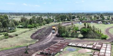
In collaboration with the National Water Harvesting Authority (NWHA), the government is implementing the West Kano-Kanyagwal Flood Control Project in Ogenya Sub-location, Kadibo Sub-county, Kisumu County, to mitigate the flood in the area.
The West Kano floods
Principal Secretary, State Department for Internal Security and National Administration, Raymond Omollo, in a Facebook post, emphasized the importance of the project in protecting residents from future floods and reclaiming land.
Also Read: KeNHA Closes Road After Floods Wash Away Major Section
The floods are caused by the area’s low-lying location, where the River Nyando drains into Lake Victoria. Since the area is low-lying, when the River Nyando flows into Lake Victoria, water easily spills over and floods the land during heavy downpour. Families living in villages, including Kanduru, Kanyangi, Kajowi, Wachiegwe, Kanyamuok, and Karagwel, have been forced to relocate temporarily or permanently.
“For many years, residents of West Kano have been affected by floods, which have led to their homes being destroyed, displacing families, and destroying infrastructure. In the recent case, the floods affected 684 homes, and 450 homes were destroyed. To address this recurring menace, the government, through the National Water Harvesting Authority, is implementing the West Kano–Kanyagwal Flood Control Project in Ogenya Sub-location, Kadibo Sub-county,” PS noted.
Also Read: Kenya Met Warns of Flash Floods and Strong Winds in 30 Counties This Weekend [LIST]
He also updated on the project process, saying it is 48% complete, designed to reclaim approximately 7,000 hectares of land.
Objective of the West Kano-Kanyagwal Flood Control Project
The project entails the construction of a 1.5-metre-high dyke spanning 3.5 kilometers, a footbridge as part of the Corporate Social Responsibility (CSR), and grassing and tree planting to stabilize the reclaimed areas.
The project is set to protect farmlands and human settlements from the frequent floods and facilitate the resettlement of displaced families, safeguarding critical public infrastructure such as schools, health centers, roads, markets, and places of worship in severely affected villages.

Follow our WhatsApp Channel and X Account for real-time news updates

